Is high-resolution satellite imagery the best in crop insurance?
Learn about the advantages and limitations of imagery technologies in the crop insurance industry.

Due to the impact of climate change, extreme weather events are hitting US farmers more frequently. Billion-dollar climate-driven disasters have increased by 115% over the last 5 years. As the need to fairly and swiftly resolve crop insurance claims increases, insurers are turning to satellite imagery to improve claims adjustments. However, the imagery market is hazy, with private companies pushing the visual appeal and greater precision of their higher-resolution images taken by satellites or drones. Yet, the highest precision doesn’t necessarily lead to the highest return on investment (ROI) for approved insurance providers (AIPs).
Instead, choosing the right level of imagery resolution depends on your use case, i.e., the question you are trying to answer. Do you want to look at tiny insects on all the crops in a few fields or, as is more likely for AIPs, assess the crop damage caused by storms across many fields? To save you time and money, we’ve dived into the advantages and limitations of imagery technologies.
A crash course on satellite imagery
Before delving into our comparison, it’s helpful to define some basic concepts. Satellite imagery is a kind of remote sensing technology. Put simply, satellites harness powerful sensors to take pictures of the Earth’s surface from space. Spatial resolution is one of the parameters to differentiate between sensors and there are the following variations:
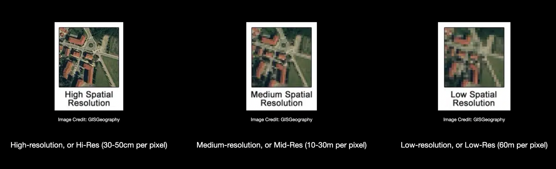
Image Credit: GISGeography
Low-resolution images are useful for a number of large-scale applications such as detecting wildfires, monitoring glaciers melting, etc. Nevertheless, when it comes to agricultural use cases, their capabilities are considerably lower than Mid-Res and Hi-Res pictures. For this reason, this piece will focus on the first two resolutions.
The strength of hi-res satellite imagery
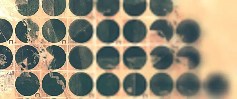
Thanks to their smaller pixel size, high-resolution images acquire more data points than Mid-Res shots for the same agricultural field. This translates into capturing a greater subfield variability. Hi-Res pictures let farmers detect pests and pathogens feasting on their crops, thus minimizing harvest losses. While this is powerful, it is important to note that, despite the lower resolution, Mid-Res images can still adequately assess crop health, albeit not on the individual plant level. Also, the large-scale land analysis that AIPs typically need doesn’t require the level of detail dictated by precision agriculture applications. For example, Mid-Res images can give enough information to determine the extent of damage caused by extreme weather on crops across several fields.
Hi-res satellite imagery vs mid-res satellite imagery
You can picture a Hi-Res satellite as a telescope, which is a tool designed to give you more granular details on a smaller area. That’s why precision farming is a relevant application of Hi-Res imagery. On the other hand, for AIP-related use cases, it’s worth considering a few factors before ruling out Mid-Res images.
1.Space and time consistency
Hi-Res satellites look at only a small ground coverage and can lack historic data. In fact, being based on an on-demand service, a.k.a. tasking, the paid satellite imagery of a certain area is not performed at a regular cadence. This is not the case with Mid-Res satellites, which scan the same area on a consistent basis, thus combining real-time frequent visuals with a more consistent historical dataset over large areas (i.e., thousands of acres). Here at PlanetWatchers, we rely on this consistent revisit for our different services, ranging from capturing acreage reporting data to supporting claims.
2.Cost and availability
Although Hi-Res is the most detailed satellite imagery you could use, it’s also more expensive. Hi-Res satellites are operated by private imagery providers, who stick a price tag on their data. Just to give you some numbers, you could pay up to approximately 0.1$/acre for a single snapshot. This would not be prohibitive for covering the average US farm, whose size is only 445 acres. However, if you want to monitor the 12.7 million acres of corn harvested in Iowa, there’s a minimum area you must buy a collection of images for, ranging between approximately 10,000 and 25,000 acres; an individual Hi-Res shot will cost you a fortune. Multiplying this by the number of shots needed in a season can quickly amount to a hefty bill. Conversely, governments subsidize the operation of medium-resolution satellites, which is why you can access several up-to-date open data Mid-Res satellite imagery sources for free.
Aside from economic barriers, time is not on the side of AIPs when going after Hi-Res images. After filing a request for them, it can take up to 2 months before receiving your data. This delay will inevitably compromise the quality of your damage assessment.
Even though Hi-Res satellite imagery is available for purchase, competition is fierce. You’ll have to deal with governments, which own most of the private providers’ collection time, and businesses willing to spend extra money to jump up the queue.
Drones are, as you might already know, another potential source of Hi-Res imagery. However, despite drone-based Hi-Res images being cheaper for very small areas and easier to acquire than satellite imagery, all the other disadvantages stated above still apply.
Conclusion
As explained in this article, keeping your use case in mind is vital when selecting a type of satellite imagery. Although costly and hard to access, Hi-Res images are an option if you want to scrutinize only a couple of fields. However, when you’re an AIP who is after up-to-date insights on large amounts of land with a historical comparison, the medium resolution offers global coverage and enough detail to tell the story of the field.
Focusing exclusively on crop insurance in North America, PlanetWatchers tells the story of every field saving our customers time and money by enhancing policy and claims validation.